GuidesRoad trips
A Kefalonia Road Trip: Argostoli to Fiskardo in Five Days
Argostoli, Melissani, Myrtos after the July 2026 landslide, Assos and Fiskardo: a five-day Kefalonia drive with honest timings and safety notes.
Contents · 9
The short version
Kefalonia is the largest of the Ionian islands and it rewards a car more than almost any other: mountain roads with long views, a coast that swings from white-pebble coves to red-clay cliffs, and villages spread far apart. Five days is a comfortable minimum. The classic line runs from Argostoli, the capital, across to Sami and its caves, up the west coast past Myrtos to Assos, and on to Fiskardo in the far north.
One thing has changed in 2026. Myrtos had a landslide in July 2026. The beach remained open, but stay well away from the base of the cliffs. More on that below; for towns and places to stay, start with our Kefalonia island guide.
Getting there and getting a car
- By air: Kefalonia airport (EFL) is about 8 km from Argostoli, with direct summer flights from many European cities. Romanians have had a new seasonal route from Bucharest — check the airline for the current season. See our airports page.
- By ferry with your own car: the crossing from Kyllini on the Peloponnese to Poros in the south-east takes around an hour and a half; there are also sailings between Patras and Sami. Timetables change by season, so check the operator and our ferries hub. Drivers coming from Romania will find the route through Bulgaria and mainland Greece on our From Romania page.
- From Lefkada: a seasonal boat links Vasiliki with Fiskardo in about an hour, from April to October, so you can combine this trip with our Lefkada beaches by car and run it north to south instead.
Rent something with a bit of power. The mountain roads are steep and winding, and a very small engine with four people and luggage makes for slow, anxious climbs. Check the insurance excess before you sign.
Day one: Argostoli and the south-west
Argostoli was rebuilt after the great earthquake of 1953, which destroyed most of the island's towns, so do not expect an old quarter. What it has is a lively waterfront, a long pedestrian street and, often, loggerhead turtles surfacing in the harbour early in the morning near the fishing boats — look, do not feed or touch.
Walk or drive out along the peninsula to the Saint Theodore lighthouse, a small colonnaded rotunda at the water's edge, and stop at the Corgialenios Museum for a sense of what the island looked like before 1953. In the afternoon, head inland to the Castle of Agios Georgios, the island's old capital on a hilltop above the southern plain, and back down for a late swim.
Day two: Sami, the caves and Antisamos
Cross the island to the east coast, a drive of well under an hour on a good road.
- Melissani Cave — an underground lake whose roof has partly collapsed, so sunlight falls straight onto the water. You are rowed across in a small boat. Tickets are around €10–13 (checked September 2026; reports vary, so confirm on the day). Go around midday for the brightest light on the water, and expect queues in August.
- Drogarati Cave — a large chamber of stalactites a short drive away; cool on a hot day and quick to visit.
- Antisamos — over the hill from Sami, a bay of white pebbles and very clear water enclosed by green slopes. The winding descent is half the pleasure.
Sami itself is a working port with tavernas along the quay, a good place for dinner before heading back or staying the night.
Day three: Myrtos after the landslide, and Assos
Take the coast road north. The first sight of Myrtos is from the road high above: a long arc of white pebbles and a sea that shades from turquoise to deep blue under towering cliffs. It is one of the most photographed beaches in Greece, and the view from the lay-by above is reason enough to stop.
In July 2026 a landslide came down at Myrtos. The beach remained open, but the cliffs behind it are clearly unstable. If you go down:
- Stay away from the base of the cliffs. Put your towel near the water, not against the rock face, and do not shelter in its shade.
- Follow any cordons or signs on the day; the situation can change after rain or further rockfall.
- Keep an eye on children — the pebbles drop steeply into deep water and the swell can be strong.
- Drive the switchbacks slowly. The access road is narrow and busy in August, and parking at the bottom fills early.
If the sea is rough or the beach feels crowded, enjoy the viewpoint and move on. Our Kefalonia beaches page has calmer options.
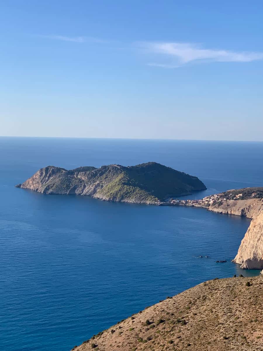
From Myrtos it is a short drive to Assos, a tiny village on a narrow isthmus below a wooded headland crowned by the Venetian castle of Assos. The walk up is long, hot and exposed, so start early or late, bring water, and wear proper shoes. The reward is the ruined walls, olive and cypress trees, and one of the best views over the village on the island. Parking in Assos is extremely limited; leave the car at the top of the descent if the village looks full.
Day four: Fiskardo and the north
Fiskardo, at the northern tip, was one of the few places on Kefalonia to survive the 1953 earthquake largely intact, and its harbour of pastel-coloured Venetian-era houses shows what the island once looked like. It is also the smartest corner of the island, full of yachts in high season. See the Fiskardo page for what to do there.
Swim at the small coves along the north-east coast, most of them pebbly and reached by short tracks. In the evening, walk out along the harbour path towards the lighthouse. If you are continuing to Lefkada, the seasonal boat from Fiskardo to Vasiliki takes about an hour.
Day five: Mount Ainos, the monastery and the west
Kefalonia's interior is as good as its coast. Mount Ainos, the island's highest mountain, is a national park covered in dark Kefalonian fir, with a road that climbs close to the summit and wide views over the Ionian on clear days. It is noticeably cooler up there — bring a layer. Wildfire rules apply in summer: no fires, no barbecues, and check the daily fire-risk map before hiking.
On the way down, stop at the Monastery of Agios Gerasimos, dedicated to the island's patron saint, in the Omala valley. Dress modestly — shoulders and knees covered.
If you still have energy, the Paliki peninsula in the west offers a different Kefalonia: the red-clay cliffs of Xi beach near Lixouri, with shallow water that suits children.
Driving tips
- Distances feel longer than the map suggests. Winding roads and slow traffic behind buses add up; do not try to see the whole island in a day.
- Watch for goats on mountain roads, and for scooters on blind bends.
- Fill up in Argostoli or Sami before heading to the north or the mountain.
- Do not use your phone at the wheel: under Greece's traffic code, in force since September 2025, it costs €350 and a one-month licence suspension (checked September 2026).
Where to base yourself
For five days, two bases work well: Argostoli or the beaches near it for the south and centre, then Fiskardo or Assos for the north. With a single base, choose somewhere central such as Sami or Argostoli and accept longer drives.
If you want more Ionian islands after Kefalonia, Zakynthos is the natural next stop — see our Zakynthos guide after the Navagio closure.
Prices, fees and rules in this piece were checked in September 2026. They change — confirm with the operator or site before you travel.
Where to stay nearby
Live prices and availability on a map centred on this exact spot — hotels, studios and villas — so you can judge the distance to the beach, the port or the village from here rather than guess from an address.
Bookings made through this map earn us a commission. Your price is unaffected.
A travel advisor who writes about Greece the way he advises on it: island by island, with the catch attached to every recommendation. More about the author →
Frequently asked
Is Myrtos beach open after the July 2026 landslide?
Yes, the beach remained open after the landslide in July 2026. Stay well away from the base of the cliffs, follow any cordons or signs on the day, and enjoy the view from the road above if conditions look poor.
How many days do you need for a Kefalonia road trip?
Five days is a comfortable minimum for Argostoli, Sami and the caves, Myrtos and Assos, Fiskardo and Mount Ainos. Winding roads make distances feel longer than they look on the map.
How much is Melissani Cave?
Tickets are around €10–13 (checked September 2026). Reports vary, so confirm on the day. Visit around midday for the best light and expect queues in August.
How do I get to Kefalonia with a car?
Take the ferry from Kyllini on the Peloponnese to Poros, around an hour and a half, or sail between Patras and Sami. A seasonal boat also links Vasiliki on Lefkada with Fiskardo from April to October.
Where should I stay on Kefalonia?
Split the trip between Argostoli for the south and centre and Fiskardo or Assos for the north. With a single base, Sami or Argostoli are the most central.
Can I see turtles on Kefalonia?
Loggerhead turtles often surface in Argostoli harbour early in the morning near the fishing boats. Watch from the quay and never feed or touch them.
Partner links · GetYourGuide
Tours, boat trips & tickets
Boat trips, guided tours of the ancient sites and tickets bookable ahead — free cancellation on most.
- Melissani Cave & MyrtosA rowing boat on an underground lake open to the sky, then the view down to Myrtos. Around midday the sun lights the water in the cave.See guided tours →
- Ithaca, Odysseus' islandA short crossing to Ithaca's harbour villages — quieter than Kefalonia and easy in a day.See day trips →
We may earn a commission from these. It never changes your price.
Before you go
We may earn a commission from these. It never changes your price.
Guides