🏝️ The North Aegean
Samos
Σάμος
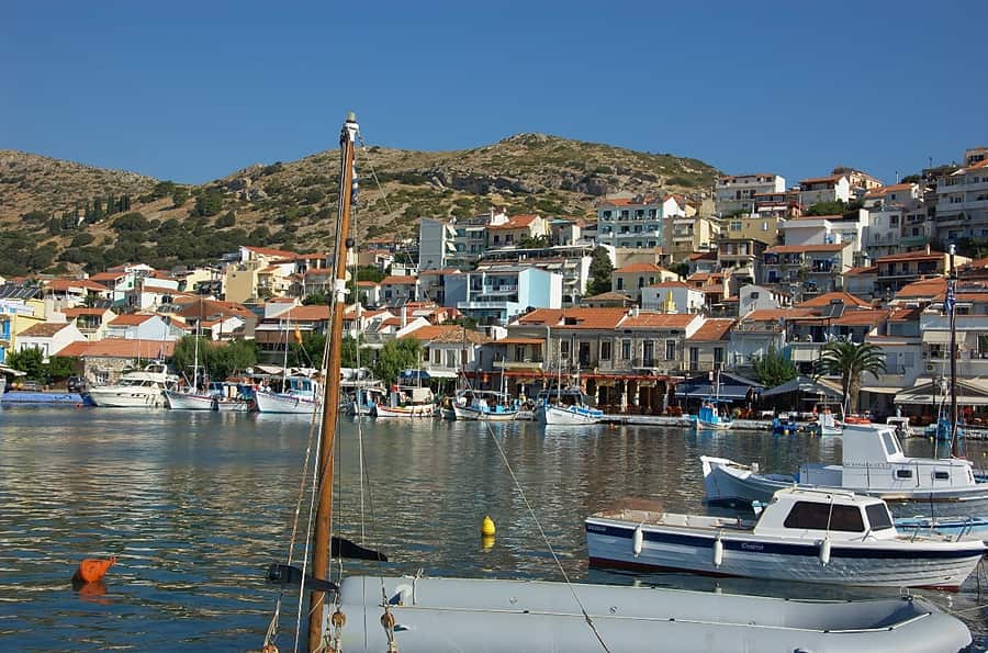
Pine forests, two mountains and a UNESCO inscription covering the Heraion and Pythagoreion. Samos grows the sweet muscat, sits a few kilometres off the Turkish coast and has the best walking in the North Aegean.
- Region
- The North Aegean
- Airport
- Samos (SMI)
- Ferry ports
- Vathy · Pythagoreio · Karlovasi
- Best for
- 🏛️ Culture🏖️ Beaches🍷 Wine🥾 Hiking👨👩👧 Families
Where to stay
Which part of Samos to stay in
You choose twice: first the island, then the part of it. These areas are the real comparison — each with its own beaches, hotels and tavernas.
- Pythagoreio & the southA yacht harbour with a castle, ruins at the edge of the pavement, the airport ten minutes away — and the two UNESCO sites that make Samos worth a detour.🏛️ 8 🏖️ 3 🍽️ 5 🛏️ 5
- Vathy & the eastSamos Town climbing the slope around a deep bay, with the kouros in its museum, the wine museum outside it and two beaches within walking distance.🏛️ 2 🏖️ 3 🍽️ 3 🛏️ 5
- Kokkari & the north coastAn old fishing village turned resort, with three pebble beaches and very clear water in a row to the west of it and the chestnut villages of Ampelos above.🏛️ 1 🏖️ 4 🍽️ 4 🛏️ 5
- Karlovasi & the westA university town with a tanning-industry past, a river gorge and waterfalls behind its beach, the coastal path to the Seitani coves, and Mount Kerkis above it all.🏛️ 3 🏖️ 4 🍽️ 3 🛏️ 3
Α · 🏖️ 14 · Samos
Beaches
Β · 🏛️ 14 · Samos
Attractions
Museum
Karlovasi Folklore Museum
KarlovasiCastle & fortress
Castle of Lykourgos Logothetis
PythagoreioΓ · 🍽️ 15 · Samos
Restaurants & tavernas
Δ · 🛏️ 18 · Samos
Where to stay
🗺️ Samos
Everything we list, on the map
Where to stay in Samos
Live prices and availability on a map centred on this exact spot — hotels, studios and villas — so you can judge the distance to the beach, the port or the village from here rather than guess from an address.
Bookings made through this map earn us a commission. Your price is unaffected.
Partner links · GetYourGuide
Tours & boat trips
Boat trips, guided tours of the ancient sites and tickets bookable ahead — free cancellation on most.
- Samos MuscatTerraced vineyards up to eight hundred metres and a PDO that runs from dry to the fortified Nectar; the cooperative museum pours the range.See wine tastings →
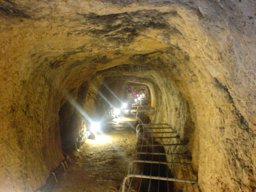
- The tunnel of EupalinosA kilometre-long sixth-century BC aqueduct driven through a mountain from both ends at once, which met in the middle. You walk a long section.Check tickets →
- Potami and the Seitani covesThe waterfalls above Potami and the coastal path to the protected coves where monk seals breed — the island's quiet strength.See guided tours →
We may earn a commission from these. It never changes your price.
The guide
Samos: our guide
Contents · 7
Green, steep and close to Asia
Samos is separated from Turkey by a strait less than two kilometres wide at its narrowest, and that proximity explains a great deal — the trade that made it rich in antiquity, the Anatolian touches in the food, the ferries that still cross to Kusadasi in season. It is also one of the greenest islands in the Aegean: two mountains, Ampelos in the middle and Kerkis in the west, hold enough rain to keep pine forest, vineyards and running water going through the summer. Wildfires have taken chunks of that forest in recent decades, and an earthquake in 2020 damaged buildings in the north; both are visible if you look.
The UNESCO pair
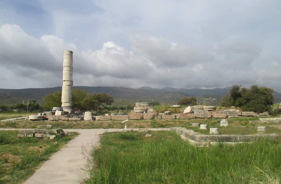
Pythagoreion and the Heraion were inscribed together on the World Heritage List in 1992, and they are a single argument about what a sixth-century BC tyrant could build. Polycrates ruled from the harbour town now named after Pythagoras, who was born here, and commissioned three works that Herodotus called the greatest in the Greek world: a mole still under the modern harbour, the enormous temple of Hera, and the Tunnel of Eupalinos — a kilometre-long aqueduct driven through a mountain from both ends at once, which met in the middle. You can walk a long section of it. Of the temple, one column stands out of a hundred and fifty-five.
Vathy, Pythagoreio and the villages
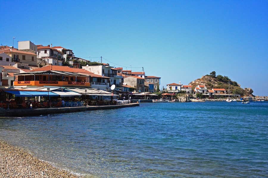
Vathy, officially Samos Town, climbs the slope around a deep bay in the north-east: a working capital with the archaeological museum and the five-metre kouros that is the largest surviving. Pythagoreio on the south coast is the pretty one, a yacht harbour with a castle, ruins at the edge of the pavement and the airport ten minutes away. Kokkari on the north coast is the old fishing village turned resort, and Karlovasi in the west is a university town with a tanning-industry past. Inland, Vourliotes, Manolates and Pyrgos sit in the chestnut forest on the flank of Ampelos.
Beaches and walking
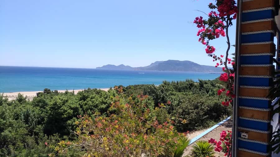
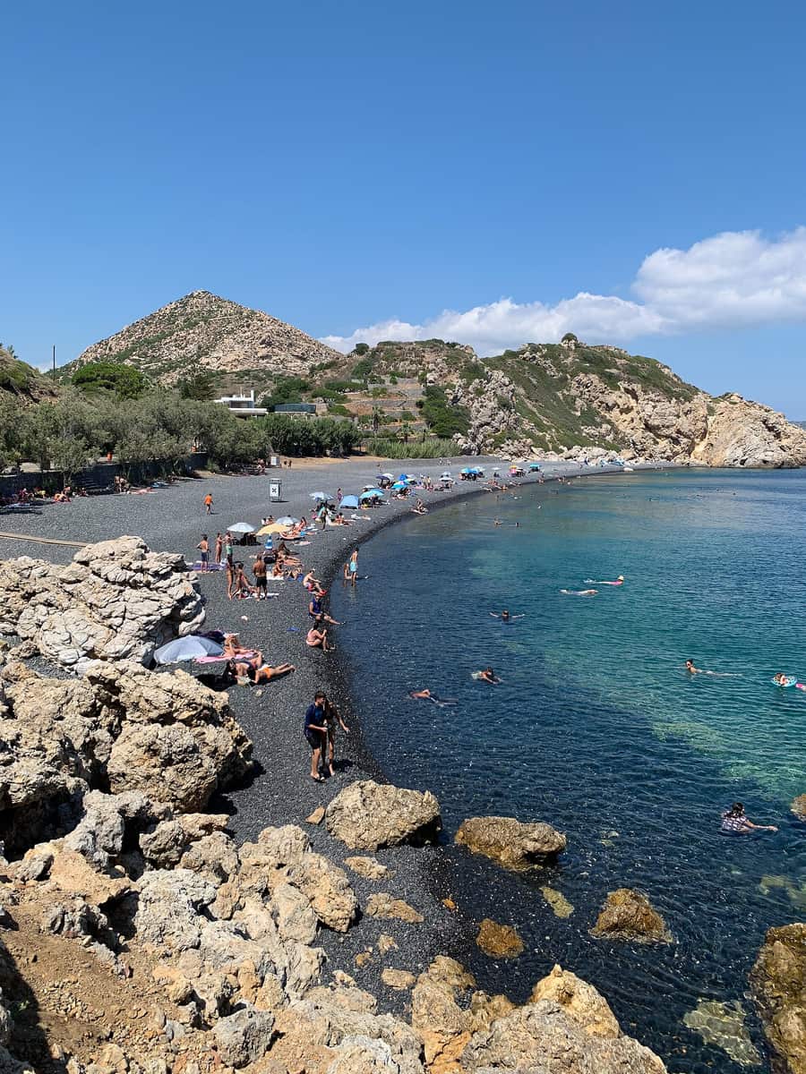
The north coast beaches are pebbles and very clear water: Tsamadou, Lemonakia and Tsabou in a row west of Kokkari, with Potami beyond Karlovasi next to a river gorge and a Byzantine chapel. The south has sand: Psili Ammos facing Turkey, and the long strip at Votsalakia under Mount Kerkis. The walking is the island's quiet strength — the Potami waterfalls, the coastal path to the protected Seitani coves where monk seals breed, and the chestnut villages linked by old kalderimia.
Muscat, and what to eat
Samos is a wine name before it is a holiday name. The island's Muscat of Alexandria, grown on terraces up to eight hundred metres, has its own PDO, and the cooperative's wine museum outside Vathy explains the system and pours the range from dry to the fortified Nectar. On the table, expect more vegetables and herbs than on a dry island, good goat, and fish on both coasts. Loukoulos at Votsalakia and the tavernas along the Pythagoreio waterfront are the obvious tables.
Getting there and around
Samos airport (SMI) takes seasonal charters from much of Europe and flights from Athens; there are three ferry ports, with Piraeus overnight services and the North Aegean line to Chios and Lesvos, plus the short crossing to Turkey. From Romania, assume a connection through Athens. See ferries and island hopping. On the island, rent a car: the roads are good but mountainous, the distances between the north and south coasts are real, and the best villages are up switchbacks the bus does not climb.
Who it is for
People who want a Greek island with somewhere to walk and something to read about, families who like pine shade as much as sand, and anyone with an interest in wine. Skip it if you are after Cycladic whitewash or a party. July and August are hot and busy on the north coast; May, June, September and October are better, and the walking season runs from March.
Frequently asked · Samos
Does Samos have an airport?
Yes — Samos (SMI). By sea, ferries dock at Vathy, Pythagoreio and Karlovasi.
Who is Samos best for?
Among the islands we cover, Samos (The North Aegean) stands out for: culture, beaches, wine, hiking and families. If that is not you, compare the nearby islands further down.
What are the best beaches in Samos?
We list 14 beaches in Samos (2 of them sandy).
Where to stay in Samos?
We list 18 hotels, 4 right on the beach. The accommodation map on this page shows live prices and availability.
What is the nearest island to Samos?
Of the ones we cover, Kos, about 101 km away as the crow flies. By sea or road the distance is longer, and a direct connection does not always exist.
The Dodecanese
Nearest islands
Measured as the crow flies from the centre of this one — a short distance on the map is not always a direct ferry, so check the routes before you plan a combination.
Before you go
Car hire from local firmsIsland rental companies rather than the international desks — usually cheaper, often with full insurance and no card deposit. On Crete, Kefalonia or Naxos a car is what gets you to the beaches the buses do not reach.Compare local cars →Scooter, ATV & bike hireThe classic island runabout for coves and hilltop villages. Wear the helmet, check what the insurance excludes, and be honest about gravel roads — they are where most rental accidents happen.Find a scooter →Car hire, budgetAn aggregator that tends to surface the lowest headline prices. Read the fuel, insurance and ferry clauses — many contracts do not allow the car on a boat.Compare prices →Car hire without a card depositUseful mainly for the deposit terms — the thing that catches people out at a rental desk with a debit card.Check terms →
We may earn a commission from these. It never changes your price.